Blue Nile State is one of Sudan’s most strategically important border regions, linking the country’s central areas with South Sudan and Ethiopia. Located in southeastern Sudan, the state has long been shaped by questions of identity, political representation, land, security and relations between the center and the periphery.
The state capital is Ed Damazine, a city located near the Blue Nile River and close to the Roseires Dam, one of Sudan’s most important water and power infrastructure sites. Because of its geography, Blue Nile has often been significant not only for local politics but also for national security, regional trade and Sudan’s wider conflicts.
Blue Nile has been closely associated with the Sudan People’s Liberation Movement–North (SPLM-N), particularly after South Sudan’s independence in 2011, when unresolved political and security arrangements in the so-called “Two Areas” — Blue Nile and South Kordofan — led to renewed conflict. The region has also been affected by displacement, humanitarian access challenges and periodic fighting involving national and local armed actors.
Since Sudan’s war began in April 2023, Blue Nile has gained renewed attention because of its location, its links to South Kordofan and South Sudan, and its potential role in the wider military balance between the Sudanese Armed Forces (SAF), the Rapid Support Forces (RSF) and other armed movements.
Overview
Blue Nile State sits in southeastern Sudan, along a sensitive border zone near South Sudan and Ethiopia. Its location gives it strategic importance for movement, trade, military access and cross-border relations. The state is also important because of the Blue Nile River and the Roseires Dam, which have long shaped Sudan’s electricity, irrigation and water-management systems.
The state has a diverse population and a history connected to Sudan’s broader debates over decentralization, political representation, cultural identity and resource distribution. These issues became especially important after the 2005 Comprehensive Peace Agreement (CPA), which ended Sudan’s north-south civil war but left major questions unresolved in areas that remained inside Sudan after South Sudan’s independence.
Blue Nile is often discussed together with South Kordofan as part of the “Two Areas.” Both regions had strong links to the Sudan People’s Liberation Movement during Sudan’s long civil war and later became central to the activities of SPLM-N.
Where is Blue Nile State?
Blue Nile State is located in southeastern Sudan. It borders Sennar State to the north, South Sudan to the south and Ethiopia to the east. Its capital, Ed Damazine, lies near the Blue Nile River and the Roseires Dam.
The state’s geography makes it important in several ways. It connects central Sudan with borderlands facing South Sudan and Ethiopia. It also sits near routes that have been used for trade, population movement, military operations and humanitarian response.
The Blue Nile River gives the state additional national importance. Water infrastructure around the river, especially the Roseires Dam, has made the area significant for Sudan’s electricity production and irrigation planning.
Why Blue Nile matters
Blue Nile matters because it combines geography, security, infrastructure and unresolved political questions.
First, the state is strategically located near two international borders. This makes it important for Sudan’s relations with South Sudan and Ethiopia, as well as for cross-border movement and regional security.
Second, Blue Nile has been part of Sudan’s long-running conflicts over power-sharing and decentralization. Many of the issues that shaped conflict in Blue Nile are linked to broader national questions: how Sudan is governed, how wealth and resources are shared, and how communities in peripheral regions are represented.
Third, the state is connected to the SPLM-N and the legacy of the Two Areas conflict. This gives Blue Nile a political and military significance that extends beyond its local boundaries.
Fourth, Blue Nile is important because of infrastructure. The Roseires Dam and surrounding power and water facilities are part of Sudan’s national infrastructure, making security developments in the state relevant to the whole country.
Blue Nile and Sudan’s conflicts
Blue Nile’s modern conflict history is closely linked to the end of Sudan’s north-south civil war and the independence of South Sudan. The 2005 Comprehensive Peace Agreement ended the war between the Sudanese government and the Sudan People’s Liberation Movement, but it did not fully resolve the political status of Blue Nile and South Kordofan.
After South Sudan became independent in 2011, tensions increased in both regions. Fighting broke out in South Kordofan in June 2011 and later spread to Blue Nile in September of the same year. The conflict involved Sudanese government forces and SPLM-N, which continued operating in areas that remained inside Sudan.
The conflict caused displacement, disrupted livelihoods and created long-term humanitarian needs. It also placed Blue Nile within Sudan’s wider pattern of center-periphery conflicts, alongside Darfur, South Kordofan and other regions where armed opposition movements challenged the political and security order in Khartoum.
Although the intensity of fighting has changed over time, Blue Nile has remained politically and militarily sensitive. Its links to SPLM-N, South Kordofan, South Sudan and Ethiopia mean that developments in the state can affect Sudan’s wider conflict dynamics.
SPLM-N and Blue Nile
The Sudan People’s Liberation Movement–North (SPLM-N) has played a central role in Blue Nile’s modern political and military history. The movement emerged after South Sudan’s independence as the northern successor to the Sudan People’s Liberation Movement structures that remained inside Sudan.
Blue Nile and South Kordofan became known as the “Two Areas” because both had been connected to the north-south civil war but remained part of Sudan after South Sudan became independent. The 2005 Comprehensive Peace Agreement included special political arrangements known as popular consultations for the Two Areas, but these processes did not resolve deeper disputes over governance, security, identity and representation.
In Blue Nile, the SPLM-N has drawn support from communities that felt politically marginalized or excluded from decision-making in Khartoum. The movement has argued for decentralization, equal citizenship and constitutional reform, while Sudanese governments have generally viewed armed SPLM-N activity as a security threat.
The SPLM-N has also experienced internal divisions. Over time, different factions emerged, most notably the faction led by Abdelaziz al-Hilu and another associated with Malik Agar. These divisions shaped the movement’s role in peace negotiations, military alliances and relations with other Sudanese political actors.
Blue Nile’s connection to SPLM-N means that security developments in the state are often linked to wider questions about Sudan’s future political system, the relationship between the center and peripheral regions, and whether peace settlements can address the root causes of conflict.
Humanitarian situation
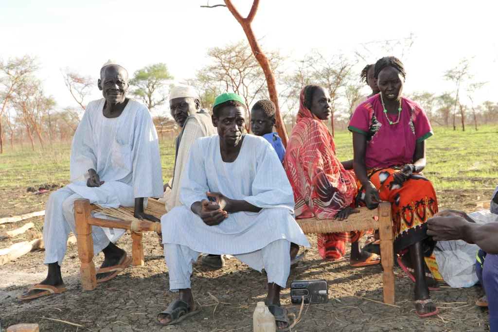
Blue Nile has experienced repeated displacement and humanitarian needs as a result of conflict, insecurity and economic disruption. Fighting in different periods has forced civilians to flee from rural areas, border zones and contested localities toward safer towns or neighboring regions.
The humanitarian situation in Blue Nile is shaped by several factors. These include insecurity, limited access to some affected areas, damage to livelihoods, pressure on host communities and the movement of displaced families. Rural communities that depend on farming, livestock, fishing and local trade are particularly vulnerable when conflict disrupts roads, markets and seasonal movement.
The state has also been affected by intercommunal violence. In 2022, deadly clashes in parts of Blue Nile caused displacement and added to existing humanitarian pressures. These incidents showed that the state’s instability is not only linked to national armed conflict but also to local disputes over land, identity, political authority and access to resources.
Since the outbreak of Sudan’s wider war in April 2023, humanitarian conditions across the country have deteriorated, and Blue Nile has not been isolated from those pressures. The state’s border location, infrastructure and links to other conflict zones make humanitarian access and civilian protection especially important.
Economy and infrastructure
Blue Nile’s economy is closely connected to agriculture, livestock, local trade and river resources. Many communities depend on seasonal farming, small-scale trade and livestock movement. Conflict can therefore have immediate effects on food security, household income and local markets.
The Roseires Dam is one of the most important infrastructure sites in Sudan. Located on the Blue Nile River near Ed Damazine and Roseires, the dam has national importance for electricity generation, irrigation and water management. Its presence gives the state strategic value beyond its local economy.
Roads linking Blue Nile to Sennar, central Sudan, South Sudan and Ethiopia also add to the state’s importance. Control of routes, towns and border areas can affect military movement, trade, aid delivery and the movement of civilians.
Because of this, insecurity in Blue Nile can have effects beyond the state itself. Disruption to infrastructure, roads or power facilities can affect wider parts of Sudan, especially during periods of national instability.
Blue Nile in Sudan’s current war
Blue Nile has gained renewed attention during Sudan’s war because of its location and its links to other conflict areas. While the main fighting after April 2023 initially centered on Khartoum, Darfur and parts of Kordofan, the conflict has increasingly affected other regions through drone attacks, ground operations, displacement and shifting military alliances.
Blue Nile is important in the current war for several reasons. It lies near South Sudan and Ethiopia, borders areas connected to SPLM-N activity, and contains infrastructure that is nationally significant. It also sits near routes that can matter for military access, civilian movement and humanitarian response.
Recent developments in and around Blue Nile have shown how Sudan’s war can expand geographically and involve multiple fronts at the same time. Fighting or reported attacks in the state are closely watched because they may affect security in southeastern Sudan, relations with neighboring countries and the balance of power between armed actors.
As with many areas in Sudan’s war, information from Blue Nile can be difficult to verify independently. Reports from military sources, local residents and political actors should be treated carefully, especially when casualty figures, battlefield gains or responsibility for attacks cannot be confirmed by independent monitors.
Recent developments
Blue Nile has remained a sensitive area during the wider Sudan conflict. Reports of fighting, drone activity and military operations have drawn renewed attention to the state’s strategic role.
Recent developments have included reported attacks around Ed Damazine and other areas, as well as military claims related to operations near border and rural zones. The state’s proximity to South Sudan and Ethiopia, and its connection to SPLM-N-linked areas, make these developments important beyond the immediate battlefield.
For Sudan’s wider war, Blue Nile is significant because it shows how the conflict is no longer limited to a few central fronts. Developments in the state can affect humanitarian access, internal displacement, infrastructure security and the political calculations of armed movements and national authorities.
Timeline
2005 — The Comprehensive Peace Agreement ends Sudan’s north-south civil war but leaves unresolved political questions in Blue Nile and South Kordofan.
2011 — South Sudan becomes independent. Fighting spreads to Blue Nile after conflict begins in South Kordofan, placing the Two Areas at the center of renewed conflict between Sudanese government forces and SPLM-N.
2012–2016 — Fighting, displacement and access restrictions continue to affect civilians in Blue Nile and South Kordofan, while peace efforts struggle to produce a lasting settlement.
2017–2020 — SPLM-N divisions shape negotiations and political alignments, with different factions taking different positions on peace talks and Sudan’s political transition.
2020 — The Juba Peace Agreement is signed by Sudan’s transitional government and several armed movements, but Abdelaziz al-Hilu’s SPLM-N faction does not join the agreement.
2022 — Intercommunal violence in Blue Nile causes deaths, injuries and displacement, highlighting local tensions over land, identity and political authority.
2023 — Sudan’s war begins between the Sudanese Armed Forces and the Rapid Support Forces, reshaping the national security landscape and creating new pressures on regions including Blue Nile.
2024–2026 — Blue Nile continues to draw attention because of its strategic location, infrastructure, border links and role in Sudan’s expanding conflict dynamics.
FAQ
Where is Blue Nile State?
Blue Nile State is located in southeastern Sudan. It borders South Sudan and Ethiopia and is connected to central Sudan through routes leading toward Sennar and other states. Its capital is Ed Damazine.
Why is Blue Nile State important?
Blue Nile is important because of its border location, its connection to South Sudan and Ethiopia, its links to SPLM-N and the Two Areas conflict, and its strategic infrastructure, including the Roseires Dam.
What is the capital of Blue Nile State?
The capital of Blue Nile State is Ed Damazine. The city is located near the Blue Nile River and close to the Roseires Dam.
What are the Two Areas?
The Two Areas refer to Blue Nile and South Kordofan. Both regions were linked to Sudan’s north-south civil war but remained inside Sudan after South Sudan became independent in 2011.
What is SPLM-N’s connection to Blue Nile?
SPLM-N has played a major role in Blue Nile’s political and military history. The movement emerged after South Sudan’s independence from structures linked to the Sudan People’s Liberation Movement that remained inside Sudan.
Why did conflict continue in Blue Nile after South Sudan’s independence?
Conflict continued because the Comprehensive Peace Agreement did not fully resolve political, security and governance disputes in Blue Nile and South Kordofan. Questions over representation, decentralization and security arrangements remained unresolved.
What is the Roseires Dam?
The Roseires Dam is a major dam on the Blue Nile River near Ed Damazine and Roseires. It is important for electricity generation, irrigation and water management in Sudan.
How has Sudan’s current war affected Blue Nile?
Sudan’s war has increased attention on Blue Nile because of its location, infrastructure, links to other conflict areas and role in the wider security landscape. The state has seen reported fighting, insecurity and humanitarian pressure.
Related reading
Sudan War Explained
Sudan Conflict Timeline
Sudanese Armed Forces (SAF)
Rapid Support Forces (RSF)
Sudan People’s Liberation Movement–North (SPLM-N)
Abdelaziz al-Hilu
Malik Agar
Kordofan Explained
Sudanese Refugees and Internally Displaced Persons
Sudan Humanitarian Crisis
Sudan Monitor
Sources
International Crisis Group
Human Rights Watch
United Nations Office for the Coordination of Humanitarian Affairs (OCHA)
United Nations in Sudan
PA-X Peace Agreements Database
World Bank documents on Sudan water and irrigation infrastructure
ReliefWeb
Sudan Now reporting